Khoyniki
 |
 |
According to historical records, Khoyniki was first mentioned in 1504 as a dependency in the Grand Duchy of Lithuania. It was incorporated into the Russian Empire in 1793, on the occasion of the Second Partition of Poland.
In 1897, the city, located in the Zone of Mandatory Residence of Jewish Subjects of the Russian Empire, had a strong community of 1,668 people (62% of the total population).
In 1919, Khoïniki was attached to the Russian Soviet Federative Socialist Republic, then transferred in 1927 to the Belarusian Soviet Socialist Republic. Khoïniki was occupied by Nazi Germany from August 25, 1941, at November 23, 1943. City status was granted to it on November 10, 1967. It was seriously affected in 1986 by the Chernobyl disaster.
Map - Khoyniki
Map


Country - Belarus
 |
 |
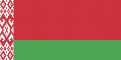
| Flag of Belarus | |
Until the 20th century, different states at various times controlled the lands of modern-day Belarus, including Kievan Rus', the Principality of Polotsk, the Grand Duchy of Lithuania, the Polish–Lithuanian Commonwealth, and the Russian Empire. In the aftermath of the Russian Revolution in 1917, different states arose competing for legitimacy amid the Civil War, ultimately ending in the rise of the Byelorussian SSR, which became a founding constituent republic of the Soviet Union in 1922. After the Polish-Soviet War, Belarus lost almost half of its territory to Poland. Much of the borders of Belarus took their modern shape in 1939, when some lands of the Second Polish Republic were reintegrated into it after the Soviet invasion of Poland, and were finalized after World War II. During World War II, military operations devastated Belarus, which lost about a quarter of its population and half of its economic resources. The republic was redeveloped in the post-war years. In 1945, the Byelorussian SSR became a founding member of the United Nations, along with the Soviet Union.
Currency / Language
| ISO | Currency | Symbol | Significant figures |
|---|---|---|---|
| BYN | Belarusian ruble | Br | 2 |
| ISO | Language |
|---|---|
| BE | Belarusian language |
| RU | Russian language |